
Do Colombia’s protected areas really protect forests? A study using Terra-i’s near real-time monitoring system


Evaluating the effectiveness of protected areas and indigenous reserves in preventing deforestation is becoming more and more important as the crucial role that forests play in climate change mitigation becomes evident. Near real-time remote sensing like Terra-i’s is proving a useful tool for detecting forest cover change trends and identifying the level of protection provided by set-aside lands.
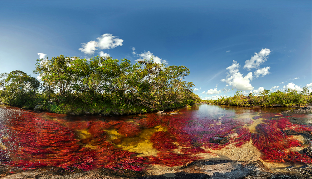
Figure 1. Caño Cristales, or “The River of Five Colors," is located in Sierra de La Macarena National Park and considered one of the most beautiful rivers in the world. Research using Terra-i data from 2005-2011 places this protected area in the “very dissatisfactory” category of conservation effectiveness. Photo: Mario Carvajal.
Information on how effectively Colombia’s protected areas network represents global and national conservation priorities is essential for developing and implementing policies that conserve forest habitats and support development goals.
Mike Salazar-Villegas, Master’s student at the Institute of International Forestry and Forest Products, recently completed his thesis work making use of Terra-i data. His main objectives were 1) to quantify the effectiveness of the Colombian protected areas network in preventing annual forest cover loss from 2005 to 2011, and 2) to identify effective and ineffective protected areas as compared with adjacent, unprotected buffer areas across Colombia.
In his research, Mike evaluated the effectiveness of 80 Colombian protected areas in preventing forest loss under three forest conservation management strategies. He mapped annual forest cover change from 2005 to 2011 using Terra-i’s near real-time remote sensing capabilities (250 m resolution) in combination with GlobCover 2005 (300 m resolution) both inside the protected areas and in a 10 km buffer around them. He used GlobCover to re-classify and identify the extent of evergreen forest cover, and based on these data developed an effectiveness index that included the percentage of forest loss inside protected areas, the annual rate of loss inside protected areas and the comparison of annual rate of loss inside and outside of protected areas.
Not all protected areas are created equal
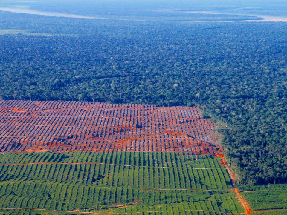
Mike found that the total forest cover area lost between 2005 and 2011 comprised 0.3% of the protected areas network and 1.1% nationwide, equivalent to 57,000 hectares of forest. Forest loss occurred in 20% of protected areas categorized as National Parks, Natural Monuments or Habitat Management Areas with strict management regimes (categories II-IV of the IUCN’s Protected Areas Categorization System). Indigenous reserves experienced the highest occurrence of forest cover loss, both inside (55%) and outside (60%) the reserves.
More than 50% of Colombia’s protected areas were classified as providing satisfactory or very-satisfactory protection levels. Protected areas with strict management schemes (categories II-IV of the IUCN system) were found more effective at preventing forest cover loss than multiple-use protected areas (indigenous reserves and IUCN category VI).
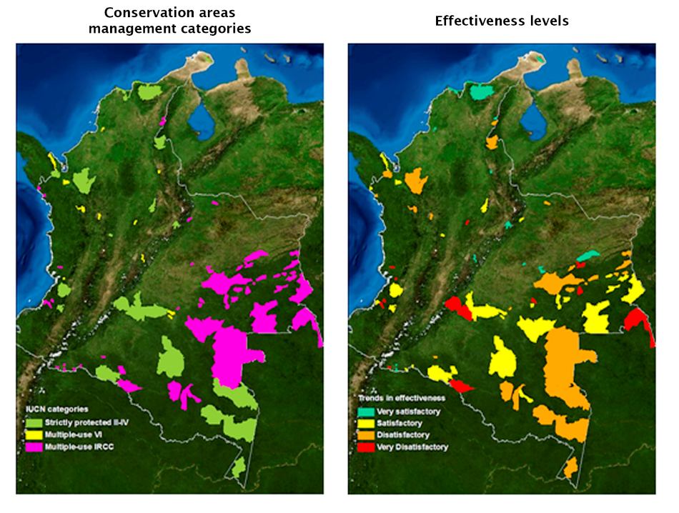
Figure 2. Spatial distribution of Colombian protected areas by IUCN category (left) and their effectiveness in preventing forest cover loss. Maps: M. Salazar
These findings suggest that loss of evergreen forest cover in the Colombian protected areas network could be substantially lower than countries in Central Africa, South and Southeast Asia. However, they do not explain how factors such as elevation, slope and socio-economic conditions may contribute to the conservation performance of individual protected areas.
The application of other empirical methods such as matching techniques is needed to control for landscape characteristics that can influence deforestation, thus providing a more holistic picture of why some protected areas are more effective than others.
Forest protection strategies can contribute both to biodiversity conservation and climate change mitigation goals. Research like Mike’s is helping to inform and influence these strategies to make sure forest cover loss both inside and outside of protected areas is understood and, ultimately, prevented.
Further information about Mike’s work can be found on the Terra-i website in the Publications (External studies) section.
The Terra-i team invites its users to share other research or initiatives making use of its data. In addition, The Terra-i team is grateful to Mike for sharing the details of his work.
Blog post by Mike Salazar. Revision of English-language version by Caitlin Peterson (CIAT / CCAFS visiting researcher).
Mike Salazar is a Master’s student at the Institute of International Forestry and Forest Products, Faculty of Forest, Geo and Hydro Sciences. He recently submitted his thesis in pursuit of a Master’s of Science degree in Tropical Forestry and Management.


IDENTIFICACIÓN DE CAUSAS DE PÉRDIDA DE COBERTURA VEGETAL EN LAS ÁREAS DE INTERVENCIÓN DE LA ACTIVIDAD GOBERNANZA EN ECOSISTEMAS, MEDIOS DE VIDA Y AGUA (USAID/GEMA) EN EL OCCIDENTE DE HONDURAS


MAPEO DE COBERTURAS DE LA TIERRA PARA EL 2017, EN EL OCCIDENTE HONDUREÑO SOBRE ÁREAS DE INTERVENCIÓN DE LA ACTIVIDAD GOBERNANZA EN ECOSISTEMAS, MEDIOS DE VIDA Y AGUA (USAID/GEMA)


CUANTIFICACIÓN DE LA DEFORESTACIÓN EN LAS ÁREAS DE INTERVENCIÓN DE LA ACTIVIDAD GOBERNANZA EN ECOSISTEMAS, MEDIOS DE VIDA Y AGUA (USAID/GEMA) EN EL OCCIDENTE DE HONDURAS


An international team of scientists*, involving entomologists, conservation biologists, agro-ecologists and geographers, has just revealed how on-farm insect biological control can slow the pace of tropical deforestation and avert biodiversity loss on a macro-scale. The case study concerns biological control of the invasive mealybug Phenacoccus manihoti with the introduced host-specific parasitic wasp Anagyrus lopezi in Southeast Asia. The results of this study have just been published in Communications Biology – Nature.


CIAT and the Terra-i team are pleased to announce the publication of a new study in Paraquaria Natural, the most prestigious journal in Paraguay dedicated to biodiversity and the conservation of nature.


New deforestation hotspots point the finger at my favourite fruit I love Terra-i, but today I hate it. A lot. The system uses satellite images to track deforestation in the Amazon in near-realtime. It’s extremely accurate: if a bunch of trees come down somewhere – no matter how remote – Terra-i picks it up. Cool, right? Not today. CIAT’s Louis Reymondin, the system’s chief architect, dropped the bombshell over coffee: it looks as though hundreds of hectares of rainforest in Peru are being trashed by… papaya.


The production of geospatial data related to land-use and land cover changes by governments and civil society organizations has vastly increased during the last decade. Going beyond the valuable information (location, rates and absolute values of changes) provided by these datasets, it is important to have a better understanding of the spatial configurations and composition of the detected change areas at multiple spatial resolutions and time periods. Alejandro Coca-Castro’s research is aiming to map types of spatial deforestation patterns in the Amazon rainforest through the integration of landscape fragmentation metrics and data mining techniques. The research will contribute to the understanding of two deforestation datasets (Terra-i and GFC) and is part of his master dissertation at King’s College London. This blog post highlights Alejandro’s research methodology, preliminary findings and challenges.


Ecuador is recognized as one of the biodiverse hotspots on earth, underneath the Amazon rainforest lies the country’s oil reservoir. With the oil companies and cleared routes come settlers, therefore more and more of this diverse rainforest is being cut down. Since the oil concerns entered the Ecuadorian Amazon 45 years ago, they keep exploring and exploiting the area. The Terra-i detections reveal a total habitat loss of 87,525 Ha, 16,943 Ha (19%) is part of protected areas, between January 2004 and February 2015.