
What future will Guianan forests face with upcoming road infrastructure projects?


Following a first stage study in 2012, a second stage of road impact assessments funded by the Inter-American Development Bank (IDB) was carried out based on Terra-i data. The aim of this study was to determine the potential impacts of road improvement and construction projects (Figure 1) in Guyana until 2022 . According to the analysis, the implementation of these projects will increase the deforestation rate by 1% on a national scale in the best-case scenario and by 18% in the worst-case scenario, compared to a baseline. The study clearly suggests that road infrastructure projects (improvement, pavement, and/or construction) can have substantive impacts on land-use change, affecting for example natural habitats coverage and leading to increased GHG emissions.
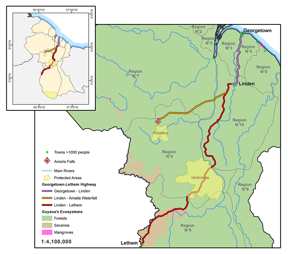
Figure 1. Localization of the 3 road sections to be improved in Guyana. Map: A. Coca-Castro.
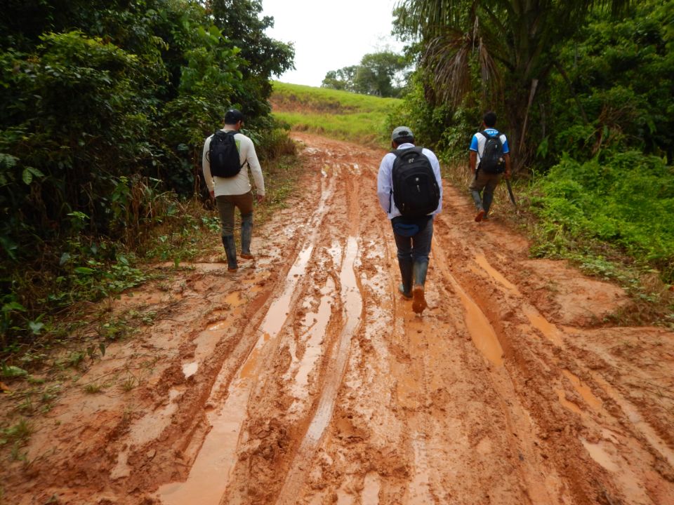
Guyana’s land area is about 21.1 million ha, which is equivalent to about 1% of the terrestrial surface of South America. The country has one of the most intact tropical forests on the continent partly due to its low population size—an estimated 778,099 people in 2010—and the country’s difficult terrain in some regions, which makes infrastructure development costly .
For this research, the overall prediction of potential deforestation in Guyana until 2022 was based on the dynamic interrelationships between the drivers and enablers of, or impediments, to deforestation, including urbanization, mining, roads, rivers, and elevations. In order to explore the different interactions of these dynamics, two “models” were developed, implying that the dynamics could be similar either to the conditions in the north of Guyana or to those of Peru’s Madre de Dios region. Both regions have experienced growing mining activities which are considered as one of the most influential drivers of forest conversion.
The results derived from the scenarios on a national scale show that the implementation of the explored infrastructure projects alone may increase deforestation by 1% on a national scale in the best-case scenario and by 18% in the worst-case scenario, in relation to the respective baseline. This predicted absolute impact of the road construction and improvements seems relatively low for Guyana in comparison with the average rates in South America. Looking more closely at the central regions of Guyana, the potential deforestation increases significantly depending on the scenario (Figure 2).

Figure 2. Potential Deforestation under Scenario of the baseline (left) and under Scenarios of Improvement and Construction of Both Roads with Current Mining (middle) and Potential Mining or the worst-case scenario (right).
Apart from evaluating the impact of road infrastructure on land-use change, the study also looked at projected GHG emissions that may result in the future if the analyzed roads are improved/paved/built (Table 1). The relevance to estimate the increase in GHG emissions enabled by the road projects may become critical in future payment schemes for reduced deforestation. Although Guyana’s emission rates might look low in comparison with other countries in Latin America, it is crucial for Guyana to maintain emission levels at 0.56% or below in order to receive the full compensation payment from the REDD+ scheme. An increase of more than 0.09%, as seen in the worst-case scenarios, will signify a loss of more than 70% in payments.
Table 1. Approximation of the Cumulative Potential Aboveground GHG Emissions Driven by Road Construction and Improvements in 10 years (SD = standard deviation).

The results of the study are proving to be useful in assessing the impact of road infrastructure projects on forest cover change and relating GHG emissions in Guyana. The methodology looks promising for ex ante environmental impact assessments that take into account the potential effects of projects on land-use change (e.g., deforestation) as well as to measure potential GHG emissions and the extent to which important carbon sinks (natural habitats) may be affected.
To read more about the results of this project you can access the full publication here (link http://publications.iadb.org/handle/11319/6369?locale-attribute=es) or access the detailed reports available at Terra-i’s publication section (link http://www.terra-i.org/terra-i/publications.html).
Acknowledgements: This consultancy project was conducted by the International Center for Tropical Agriculture (CIAT) for the IDB’s VPS/ESG and was supported with funds from the German Bundesministerium fuer wirtschaftliche Zusammenarbeit und Entwicklung (BMZ) (Federal Ministry for Economic Cooperation and Development) within the framework of a cooperation program between the IDB and the Deutsche Gesellschaft fuer Internationale Zusammenarbeit (GIZ).
Blog post by Alejandro Coca-Castro. Revision of English-language version by Nora Guerten (CIAT / DAPA visiting researcher).


IDENTIFICACIÓN DE CAUSAS DE PÉRDIDA DE COBERTURA VEGETAL EN LAS ÁREAS DE INTERVENCIÓN DE LA ACTIVIDAD GOBERNANZA EN ECOSISTEMAS, MEDIOS DE VIDA Y AGUA (USAID/GEMA) EN EL OCCIDENTE DE HONDURAS


MAPEO DE COBERTURAS DE LA TIERRA PARA EL 2017, EN EL OCCIDENTE HONDUREÑO SOBRE ÁREAS DE INTERVENCIÓN DE LA ACTIVIDAD GOBERNANZA EN ECOSISTEMAS, MEDIOS DE VIDA Y AGUA (USAID/GEMA)


CUANTIFICACIÓN DE LA DEFORESTACIÓN EN LAS ÁREAS DE INTERVENCIÓN DE LA ACTIVIDAD GOBERNANZA EN ECOSISTEMAS, MEDIOS DE VIDA Y AGUA (USAID/GEMA) EN EL OCCIDENTE DE HONDURAS


An international team of scientists*, involving entomologists, conservation biologists, agro-ecologists and geographers, has just revealed how on-farm insect biological control can slow the pace of tropical deforestation and avert biodiversity loss on a macro-scale. The case study concerns biological control of the invasive mealybug Phenacoccus manihoti with the introduced host-specific parasitic wasp Anagyrus lopezi in Southeast Asia. The results of this study have just been published in Communications Biology – Nature.


CIAT and the Terra-i team are pleased to announce the publication of a new study in Paraquaria Natural, the most prestigious journal in Paraguay dedicated to biodiversity and the conservation of nature.


New deforestation hotspots point the finger at my favourite fruit I love Terra-i, but today I hate it. A lot. The system uses satellite images to track deforestation in the Amazon in near-realtime. It’s extremely accurate: if a bunch of trees come down somewhere – no matter how remote – Terra-i picks it up. Cool, right? Not today. CIAT’s Louis Reymondin, the system’s chief architect, dropped the bombshell over coffee: it looks as though hundreds of hectares of rainforest in Peru are being trashed by… papaya.


The production of geospatial data related to land-use and land cover changes by governments and civil society organizations has vastly increased during the last decade. Going beyond the valuable information (location, rates and absolute values of changes) provided by these datasets, it is important to have a better understanding of the spatial configurations and composition of the detected change areas at multiple spatial resolutions and time periods. Alejandro Coca-Castro’s research is aiming to map types of spatial deforestation patterns in the Amazon rainforest through the integration of landscape fragmentation metrics and data mining techniques. The research will contribute to the understanding of two deforestation datasets (Terra-i and GFC) and is part of his master dissertation at King’s College London. This blog post highlights Alejandro’s research methodology, preliminary findings and challenges.


Ecuador is recognized as one of the biodiverse hotspots on earth, underneath the Amazon rainforest lies the country’s oil reservoir. With the oil companies and cleared routes come settlers, therefore more and more of this diverse rainforest is being cut down. Since the oil concerns entered the Ecuadorian Amazon 45 years ago, they keep exploring and exploiting the area. The Terra-i detections reveal a total habitat loss of 87,525 Ha, 16,943 Ha (19%) is part of protected areas, between January 2004 and February 2015.